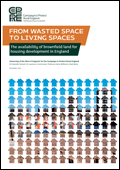
Amidst new political focus on the potential of brownfield land, a report from the Campaign to Protect Rural England (CPRE) published today shows that local authorities have identified the capacity for at least 1 million new homes on suitable brownfield land in England. The report also makes a series of recommendations that would make brownfield land more attractive to developers and encourage local authorities to do more to identify suitable sites. [1]
With estimates for brownfield capacity previously ranging from 200,000 to 1.8 million, the report provides the first comprehensive figure for brownfield capacity since the end of mandatory local authority submissions to the National Land Use Database (NLUD) in 2010. [2]
Based on research conducted for CPRE by the University of the West of England (UWE), From wasted space to living spaces concludes that a minimum of 976,000 new homes could be built on identified brownfield sites. But the researchers note that even this figure underestimates suitable land as it only identifies land already derelict or with planning permission; it does not include currently underused land that could be used for housing, such as car parks, or new brownfield land that will become available. [3]
 Report
From wasted spaces to living spaces (5.8MB PDF)
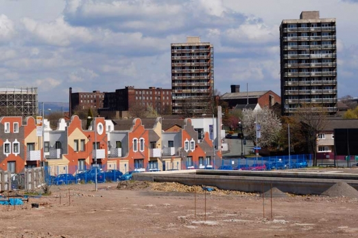
Within the 976,000 figure, the report finds that brownfield land with either detailed or outline planning permission is ready to accommodate more than 400,000 houses, while currently vacant or derelict land without planning permission could accommodate more than 550,000. Nearly half of this vacant space is located in the south east, the east of England and London, which itself could house 146,000 homes.
UWE conducted its analysis with data collected from a survey of local planning authorities. Before 2010 local authorities submitted data on available land to the NLUD, which consequently provided a national picture of brownfield land available for housing. Planning data from the 82 local authorities that provided figures for 2011 and 2012 indicate that in the period 2010-2012 the total amount of suitable brownfield land actually increased by 67 hectares despite 1658 hectares being redeveloped.
Paul Miner, planning campaign manager at the Campaign to Protect Rural England (CPRE), comments:
“This research demonstrates the huge existing capacity for housing on brownfield land. At a time when there is great pressure on our green spaces, utilising this land through a brownfield first policy would protect our countryside and regenerate urban areas.
“We want this new, authoritative evidence to lead to a sustained focus on suitable brownfield land. We can and must do more to get these sites redeveloped, whether it be reviving the National Land Use Database or implementing strong local plans to deal with multiple landowners on difficult sites.”
Housing and Planning Minister Brandon Lewis comments:
“We welcome this report, which illustrates the scope for building new homes and protecting the countryside at the same time.
“This government wants to see the maximum amount of brownfield land being used to build new homes, whilst also maintaining protections for our beautiful countryside. That is why our planning reforms encourage councils to use brownfield land for new buildings, free up disused public sector land for redevelopment and why we’ve invested £235 million into bringing 80,000 long term empty homes back into use since 2010.
“We are proud to be building more homes to support hard working families and help first time buyers onto the property ladder.”
ENDS
Notes to Editors
[1] From wasted space to living spaces is available on the CPRE website with a foreword by Richard Rogers. More detailed regional and local breakdowns are available here
[2] The National Land Use Database, owned by the Homes and Communities Agency, aims to provide national and regional trends in the availability of previously developed land (PDL), and is compiled from information on individual sites supplied by local authorities across England.
[3] As an example of calculations including underused land and future brownfield land, the 2014 Further Alterations to the London Plan states that brownfield ‘opportunity areas’ in the capital could provide 300,000 new homes alongside 568,000 jobs (see paragraphs 2.58-2.60).
If you would like to talk to report co-author Paul Miner about the report in more detail then please contact Benjamin Halfpenny on 020 7981 2819 or This email address is being protected from spambots. You need JavaScript enabled to view it.
The Campaign to Protect Rural England (CPRE) fights for a better future for the English countryside. We work locally and nationally to protect, shape and enhance a beautiful, thriving countryside for everyone to value and enjoy. Our members are united in their love for England’s landscapes and rural communities, and stand up for the countryside, so it can continue to sustain, enchant and inspire future generations. Founded in 1926, President: Sir Andrew Motion, Patron: Her Majesty The Queen. www.cpre.org.uk


