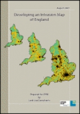
We have developed a method of mapping areas of intrusion in England. These are areas disturbed by the presence of noise and visual intrusion from major infrastructure such as motorways and A roads, urban areas and airports. The resulting maps show the extent of intrusion in the early 1960s, early 1990s and 2007. This technical report explains how we created our intrusion maps. It gives the distance thresholds which define areas of intrusion and lists the national datasets used. It also includes full statistical tables of areas disturbed and as yet undisturbed by noise and visual intrusion for each time period for England, its regions, counties and unitary authorities.
Developing an Intrusion Map of England
Prepared for CPRE by Land Use Consultants
 Cover: Developing an Intrusion Map of England
- Document type: Report
- Author: Campaign to Protect Rural England
- Format: A4, 63pp
- Publication date: September 2007
- Developing an Intrusion Map of England


